
Sounion
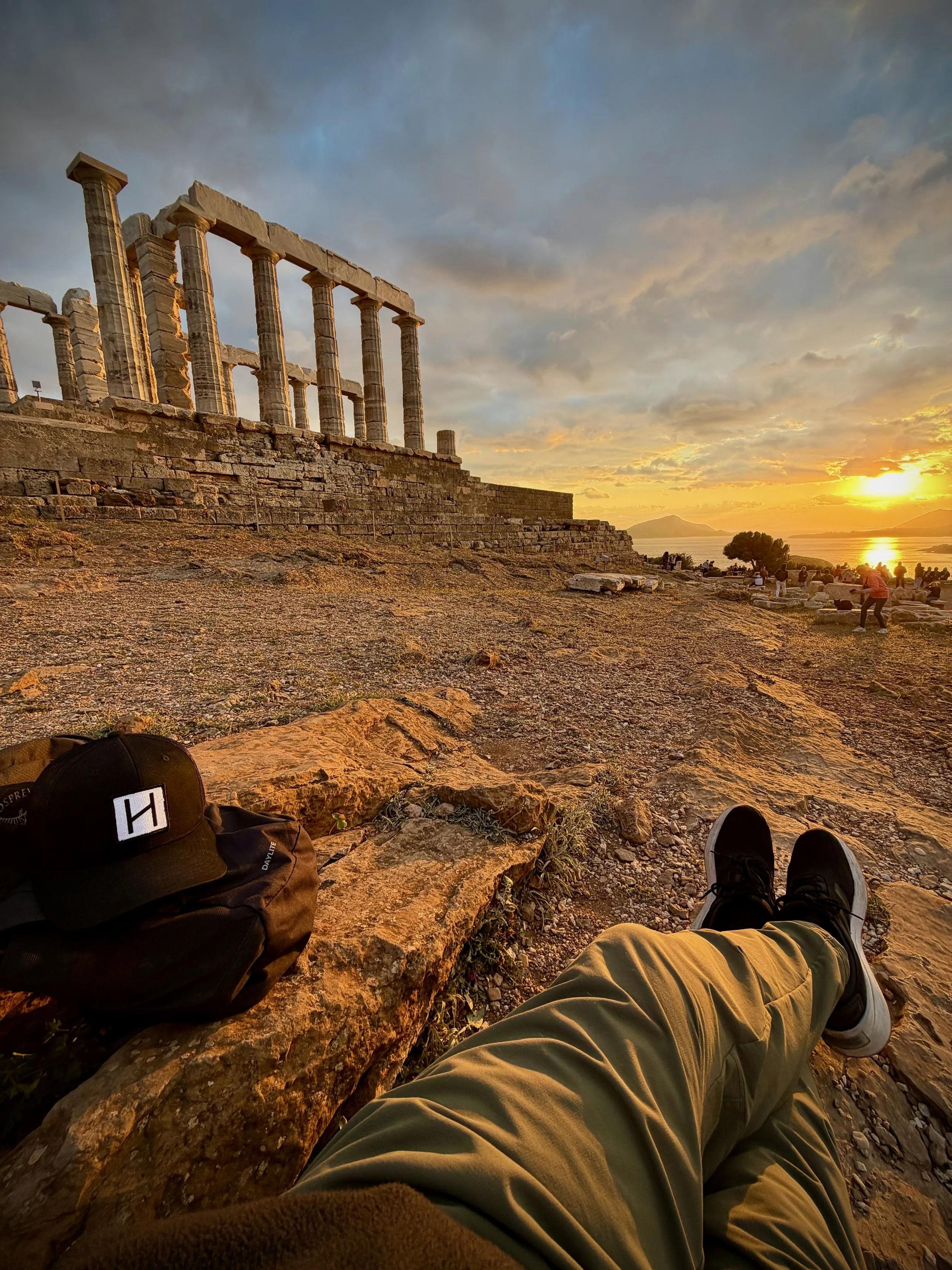
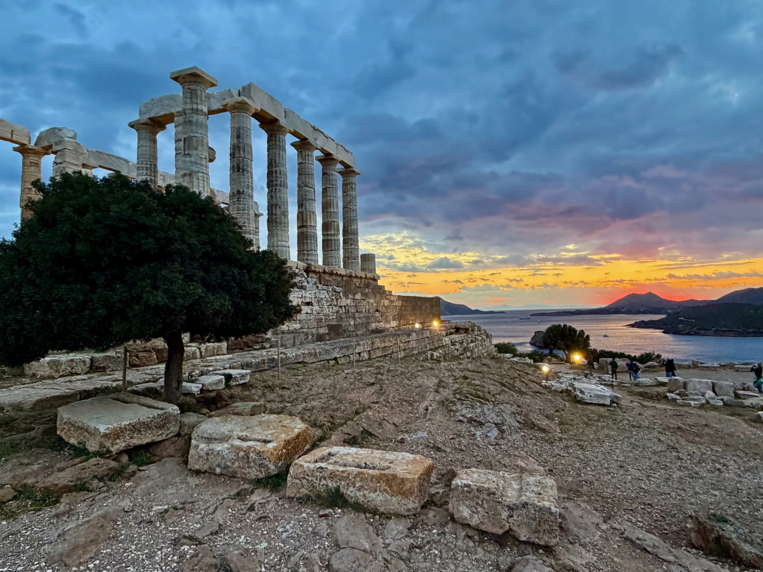
Sounion - White Doric columns on the last cliff of Attica, built for Poseidon, god of the sea, and still the mark every sailor looks for when the land of Athens falls astern.
The Greeks called the headland Sounion, or Akron Sounion. The temple stands at the southern tip of Attica, in Greece.
Wikipedia
https://en.wikipedia.org/wiki/Temple_of_Poseidon,_Sounion
Founded
There was a sanctuary on this cape by the eleventh century BCE, and an Archaic temple by the sixth. The Persians destroyed that earlier building in 480 BCE. The marble temple you see now was raised between about 444 and 440 BCE, in the years when Pericles was rebuilding Athens.
Quote
“But when he came to holy Sounion, the cape of Athens, there Phoebus Apollo slew with his gentle shafts the helmsman of Menelaus, Phrontis.”
— Homer, Odyssey 3.278–280
History
Sounion is a working cape before it is a ruin. It is the corner where Attica ends and the Aegean begins, the headland a ship had to round to get from the Saronic Gulf into the open water that leads toward the Cyclades. Athens put a temple to Poseidon on that corner for the same reason a later age put a lighthouse on it. The god who shook the sea was also the god who might let you home.
The first stone temple here was Archaic. The Persians burned it in 480, in the same campaign that left the Acropolis in ashes. A generation later, in the 440s, the Athenians built again in local marble. The new temple was Doric, six columns by thirteen, a sibling in spirit to the work Pericles was ordering in the city. Sixteen of those columns are still standing. The platform hangs on three sides over the water. From the boat the building is a small white comb against the sky. From the terrace the sea is the whole point of the architecture.
Homer already knew the cape. In the Odyssey Menelaus, running home from Troy, loses his helmsman Phrontis at Sounion and buries him there. That is why this listing carries the Odyssey tag. The poem does not describe the marble you see. It describes the headland, which has not moved.
Athens also fortified the cape. In the Peloponnesian War this was a lookout and a small naval station, with shipsheds on the northwest slope. The temple sat in the southeast corner of that fortress. You can still trace wall and terrace if you walk off the postcard angle. Lord Byron carved his name into a column in 1810, which is neither an ancient dedication nor a reason to add your own.
There is a second sanctuary a little inland, to Athena. Most visitors never walk over to it. The Poseidon temple is the one that holds the sunset and the shipping.
Location
Cape Sounion, Lavreotiki, East Attica, Greece.
Coordinates
The temple: 37° 39.01′ N, 024° 01.28′ E
The usual anchorage west of the cape: about 37° 39.4′ N, 024° 01.3′ E
Lavrio marinas, for fuel, water, and a proper berth: the town lies about eight kilometres north.
From the water
This is one of the few sites in the guide that is the landfall. The columns show from a long way off, which is why Venetian sailors called the point Capo Colonne. Closing the cape from the south or west, you see temple, cliff, and open water in a single frame. Sunset is the hour everyone knows about, and for once the crowd is not wrong.
Cruising access
The bay immediately west of the cape is the stop most yachts use. It is not a harbour. It is an anchorage under the temple, with a beach, a couple of tavernas, and a path up to the ticket gate. The bottom is sand over rock and weed in places, and the holding needs to be tested. In a meltemi the cape throws gusts and a wrap of swell. Arrive early in summer. By mid-afternoon the bay is often full.
From the anchorage you can dinghy to the beach and walk up. That is a genuine one-dinghy visit. Lavrio, a short motor north, is where you go when you want a marina, a yard, or a night that does not depend on the hook.
Museum
There is no large museum on the cape. A small site exhibition and the usual boards are at the entrance. The finds that left Sounion live mainly in Athens.
Practical notes
The temple is a short, steep walk from the bay. Give yourself time on the terrace rather than treating it as a ten-minute tick. Sunset is beautiful and crowded. Morning is quieter and better for photographs that do not include a tour group on every step. Stay off the columns. Byron already made the point.
Pilot books
Heikell’s Greek Waters Pilot covers Sounion and Lavrio in the Attica and Saronic pages. Noonsite treats the bay as a useful wait-out for the meltemi and a walk to the temple, which is the right way to think of it.
From here
Lavrio is the practical port and the start of a jump toward Kea and the Cyclades. Thorikos, just north of Lavrio, is the older industrial and theatre site that belongs to this same mining coast. Piraeus and the Acropolis lie back up the Attic shore if you are bound for Athens. Poseidon’s other great coastal mark in this guide is the sea itself. The next temple that watches a cape this cleanly is a different voyage.
“But when he came to holy Sounion, the cape of Athens, there Phoebus Apollo slew with his gentle shafts the helmsman of Menelaus, Phrontis.”
— Homer, Odyssey 3.278–280
Monemvasia
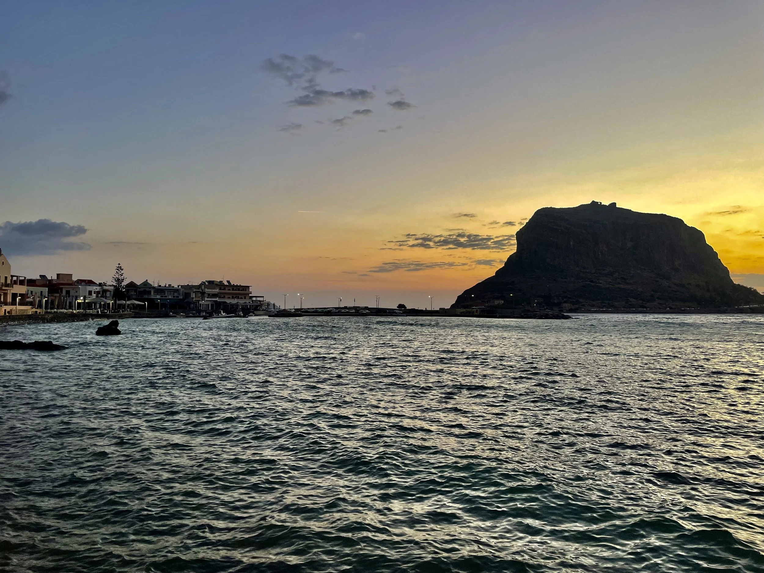
Monemvasia - From a few miles offshore the rock looks like an island citadel that has come unmoored from the mainland, until the causeway shows itself and you see why the town has only one gate.
The Greek name is Monemvasía, which means “the single entrance.” Venetian merchants called the place Malvasia, and that is how medieval Europe learned to say it. The rock is in Greece, on the east coast of Laconia in the Peloponnese.
Wikipedia
https://en.wikipedia.org/wiki/Monemvasia
Founded
An earthquake in 375 CE tore this slab of limestone away from the Laconian shore. In 582 or 583, during the reign of the emperor Maurice, people from inland Lacedaemon climbed onto it to escape Slavic and Avar raids. The upper town was settled first. The lower town, pressed between the cliff and the sea, grew later.
Quote
“But as he was rounding Malea, the wave and current and the North Wind beat him back and drove him past Cythera.”
— Homer, Odyssey 9.80–81
Cape Maleas lies about fifteen nautical miles south of here. Homer never names this rock. He names the cape that begins as soon as you leave its shelter.
History
Monemvasia is not a classical city that happens to stand near a harbour. It is what this coast did when the old cities of the Peloponnese could no longer protect the people who lived in them. The first families on the plateau were refugees. They chose a place that could not be walked around.
For a sailor the approach still explains the architecture. The rock is roughly a kilometre long and three hundred metres across. The seaward faces are too steep for an army. The only practical landing is on the mainland side, where a short causeway now joins the village of Gefyra to a single vaulted gate in a high wall. Once you are through that gate you are in the lower town: one main street running east, houses stacked against each other, the sea always close on the south side. Churches occupy whatever pocket of level ground the slope allows. You will notice a Byzantine wall, a Venetian doorframe, and the outline of an Ottoman conversion without anyone needing to put a sign on them.
By the tenth century the Byzantines were treating Monemvasia as a naval and commercial station on the long run between Constantinople and the west. Arabs and Normans failed to take it. After the Fourth Crusade the Franks of the Principality of Achaea finally starved the garrison out in 1248 and 1249. The Byzantine Despotate of the Morea recovered the rock in 1262. Through all of that the port kept shipping the sweet wine that western ledgers called Malmsey or Malvasia, which is only an Italian attempt to pronounce the place-name. The same cliffs that sent the barrels out also sheltered corsairs.
After Constantinople fell in 1453, Monemvasia was one of the last Byzantine holdings left in the Peloponnese. Thomas Palaiologos could not defend it. The rock passed to Pope Pius II and then, in 1463, to Venice. Venice held it from 1463 to 1540 and again from 1690 to 1715. The Ottomans held it in the years between. No one ever took the gate by storm. The town changed hands by blockade, famine, and treaty. In July 1821 it became the first fortress in the Peloponnese to come over to the Greek cause.
What you walk now is that whole sequence in an afternoon. The lower town is inhabited again. There are rooms for the night and a few tables in the street. The upper town is a climb: a steep, worn path to the plateau, a lot of wind, and the church of Agia Sophia sitting on the cliff edge as if it had been set down on the bow of a ship. The climb is worth it even on a hot day. The view from the church is the reason anyone ever thought this rock could be a town.
If you are bound south from here, look at Maleas as its own problem. The citadel is shelter. The cape is the passage that turned Odysseus around.
Location
Monemvasia, Laconia, Peloponnese, Greece. The mainland village at the west end of the causeway is Gefyra.
Coordinates
Harbour and small marina, WGS84: 36° 41.09′ N, 023° 02.39′ E
The gate on the rock: 36° 41.16′ N, 023° 03.20′ E
The bay to the north, often called Palaia Monemvasia: 36° 43.8′ N, 023° 02.1′ E
From the water
The rock reads as an island until you are close enough to see the causeway. At sunset the western face goes into shadow while the crown holds the last light. You will almost certainly take a photograph before the lines are made fast. That is the right instinct. This is one of the few sites in the guide that is the harbour view rather than a taxi ride inland.
Cruising access
The working harbour is at Gefyra, immediately west of the causeway. From the quay it is a short walk across the bridge to the gate. Shops, a bakery, and the usual provisions are on the mainland side, which is useful, because the lower town on the rock is prettier and more expensive.
There is a ferry mole north of the bridge. It can be a reasonable alongside berth in settled weather and an uncomfortable one when the meltemi is blowing. If the harbour is crowded or the swell is wrapping in, the bay a few miles north offers a fair-weather alternative and puts you closer to the older ruins at Epidauros Limera.
Set the anchor with some care. Parts of the harbour bottom are rock and weed, and the hook should be watched until you trust it. At night the hills can send down gusts that are harder than the afternoon forecast suggested. Water on the quay has sometimes been brackish. None of this is a reason to pass the place. It is only a reason not to treat the harbour as a marina in the Italian sense.
You can dinghy to the causeway from a nearby anchorage in settled conditions. The rock itself is closed to cars. Once you are at the gate, you are on foot.
Museum
The archaeological collection in the lower town is small and worth an hour when the plateau is too hot. It holds icons, marble, and finds from the rock and from Epidauros Limera.
Practical notes
Leave any hired car in Gefyra. Start the climb to the upper town early or late; there is almost no shade on the path. If you are heading south the next morning, give Cape Maleas its own weather window. The old advice about staying well off that headland is still good.
Pilot books
Rod Heikell’s Greek Waters Pilot covers Monemvasia in detail. In the fourteenth edition the plan is around page 248. Check the current supplement, because the harbour has been extended since some older copies were printed.
From here
The classical ruins at Epidauros Limera lie a few miles to the north and are the ancient city that belongs to this stretch of coast. If you continue south, Kythira and Elafonisos are the next harbours after you have rounded Cape Maleas. Mystras is a different kind of day. You will need a car from Gefyra, but the ruined Byzantine city in the hills is the inland counterpart to the rock you have just walked.
“But as he was rounding Malea, the wave and current and the North Wind beat him back and drove him past Cythera.”
— Homer, Odyssey 9.80–81